Topics this week include:
Planes, Train[ing] and Automobiles
Hard deck
Kern-als of wisdom

FLYING LESSONS uses recent mishap reports to consider what might have contributed to accidents, so you can make better decisions if you face similar circumstances. In most cases design characteristics of a specific airplane have little direct bearing on the possible causes of aircraft accidents—but knowing how your airplane’s systems respond can make the difference in your success as the scenario unfolds. So apply these FLYING LESSONS to the specific airplane you fly. Verify all technical information before applying it to your aircraft or operation, with manufacturers’ data and recommendations taking precedence. You are pilot in command and are ultimately responsible for the decisions you make.
FLYING LESSONS is an independent product of MASTERY FLIGHT TRAINING, INC.
Pursue Mastery of Flight™
This week’s LESSONS
Planes, Train[ing] and Automobiles
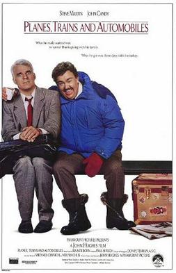
Planes, Trains and Automobiles is a classic Thanksgiving holiday movie. A harried advertising executive (played by Steve Martin) and an annoying, extroverted shower curtain ring salesman cross paths on an ill-fated attempt to fly from New York to Chicago in time for Thanksgiving. Despite their differences, after their flight is diverted by a snowstorm (to Wichita, Kansas, oh dread!) they find themselves using whatever transport they can (hence the title) over two days to make it home just in time. It may be because I’m older now, or it may be I’ve watched the movie pretty much every year since it came out in 1987, so to me the plot seems to drag in places now. But I have nostalgia for the fact that I used to think it is hilarious, so I can’t let a Thanksgiving go by without watching this holiday classic.
One theme in the movie is to keep your options open and to take advantage of opportunities when they arise. Along with a youth spent flying the airlines by non-revenue “company” standby back and forth between home in Hawaii and relatives and later college in the Midwest, it reinforces LESSONS that apply to my personal flying today. I frequently find Mastery of Flight(TM) fodder flying a Beech Bonanza from Wichita to near Cincinnati, Ohio for Thanksgiving with my family. This year’s decision-making practice, experience and reinforcement was no exception.
My 609 nautical mile trip was scheduled for the Friday after Thanksgiving (my siblings and our families celebrate together on Saturday after dinners with our individual families Thursday). Earlier in the week the forecasts for Friday and my return Sunday included a high probability of snow in the eastern third of the trip. But as the week progressed the forecasts improved. My backup to the plane was my automobile, and it was looking like I’d be able to make the 3.5-hour trip by air rather than spending 13 hours each way in my Subaru.
By Thanksgiving morning the weather looked great. I briefed and filed, knowing I’d update my briefing again before my Friday departure. But the Thursday evening updates to the “Prog” (Prognostic) charts, the Graphical Forecasts for Aviation (GFAs) and the Terminal Aerodrome Forecasts (TAFs) reintroduced fairly low clouds and a chance of snow showers from Central Illinois to my destination and beyond. When I went to bed Thursday night I was thinking I might have to trade ‘plane for automobile after all. When I awoke early the next morning, though, I developed a new plan. I could fly as far east as possible in clear skies, then descend to below the cloud bases—averaging about 3300 to 4000 feet above ground level, or 3800 to 4700 feet Mean Sea Level depending on location (MSL), with excellent visibility beneath the overcast—to avoid ice before I reached the cloud deck over eastern Illinois.
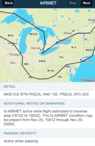
An AIRMET for airframe icing posted that morning and valid for my route “passing time” confirmed the need to stay out of the clouds.
Looking closely at the charts and the Off Route Obstruction Clearance Altitude (OROCA) I chose 3000 feet MSL as my “hard deck.” If Air Traffic Control (ATC) could not clear me to cruise that low I could cancel IFR and continue under visual flight rules at 3000 feet beneath the clouds with plenty of alternate airports available if the clouds dropped further or if snow showers limited visibility.
Worst case: I could fly as far as Terre Haute, Indiana (on the state’s west border), land at the tower-controlled airport there, rent a car and drive three hours from there to my brother’s house. Consolation: I have an attractive “dry” rental rate on the A36 Bonanza and buy my own fuel, but it’s not cheap. Renting a car for three days to drive from Indiana to Ohio and back would be less expensive than flying the hour from Terre Haute to Hamilton and a little more than an hour back into the western wind. Using planes and automobiles (no trains) was far preferable to driving 13 hours each way from Kansas. I filed and flew, initially at 9000 feet.
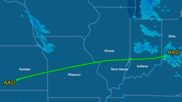
As I flew I watched the satellite view on my portable Sirius/XM receiver (a Garmin 796 GPS). On the hour I clicked on numerous airport symbols on the 796 for the latest METAR updates. The forecast was holding for the most part, with one addition: lower conditions were slowly drifting down from the north, along with snow showers that limited visibility. The lower conditions were just north of and roughly parallel to my route of flight.
Meanwhile the receiver and my ADS-B-linked iPad software showed several recent PIREPs (Pilot Reports) near my route and in the Cincinnati area (near my destination) reporting moderate ice in the clouds from 4000 to the tops at 6000 feet…strong reinforcement of my need to stay out of the clouds, especially since two of the reports came from departing Regional Jets that climbed through those clouds rapidly and still encountered substantial ice. Flying level in those icy clouds in a Bonanza could be deadly. And I didn’t want to get trapped above them.
Mirrored by the satellite weather image on my portable, on schedule a thin but growing line of clouds appeared soon after I crossed the Mississippi River eastbound. The radar image and METARs, however, showed the snow showers and lowering clouds were drifting across the northern part of my route, where I doglegged north about 20 miles to work around a Restricted Area at Columbus, Indiana that I’ve never been able to get clearance through. I took another look at the OROCAs and came up with an alternative. When St. Louis Approach handed me off to Kansas City Center (from experience I know this happens shortly after crossing the river) I checked in saying “…level niner thousand, request.” ATC asked what I wanted and I replied, “I’d like to change my route of flight to direct Hoosier [a VOR at Bloomington, Indiana], direct YUPUR [an intersection to get me around the south side of that same Restricted Area], direct destination, at 3000 feet if you can clear me that low.”
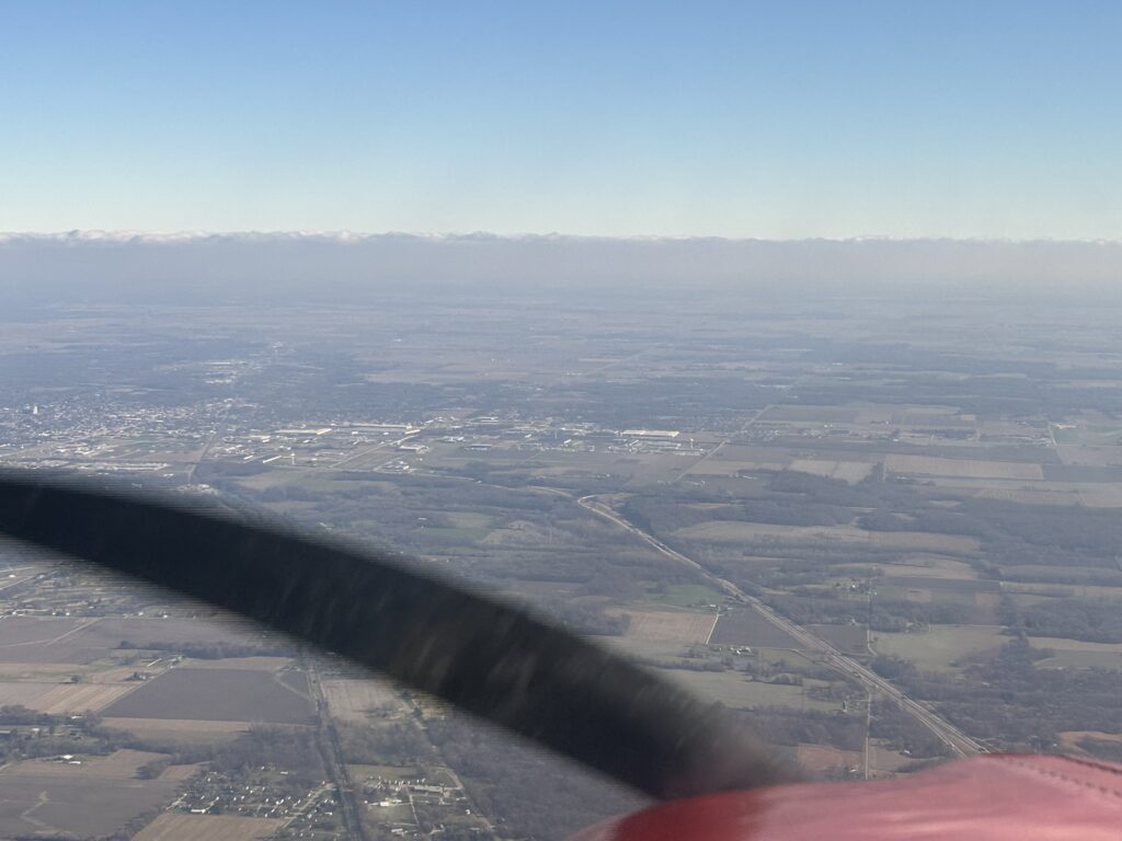
Clouds ahead, right on schedule. Time to descend.
I still had the option of cancelling IFR and proceeding VFR if they could not grant that altitude. I could land at Bloomington or go back to Terre Haute if weather demanded, and rent a car there. But without missing a beat the controller came back: “Cleared direct Hoosier, YUPUR, direct, descend and maintain 3000 feet.” I love it when a plan comes together.
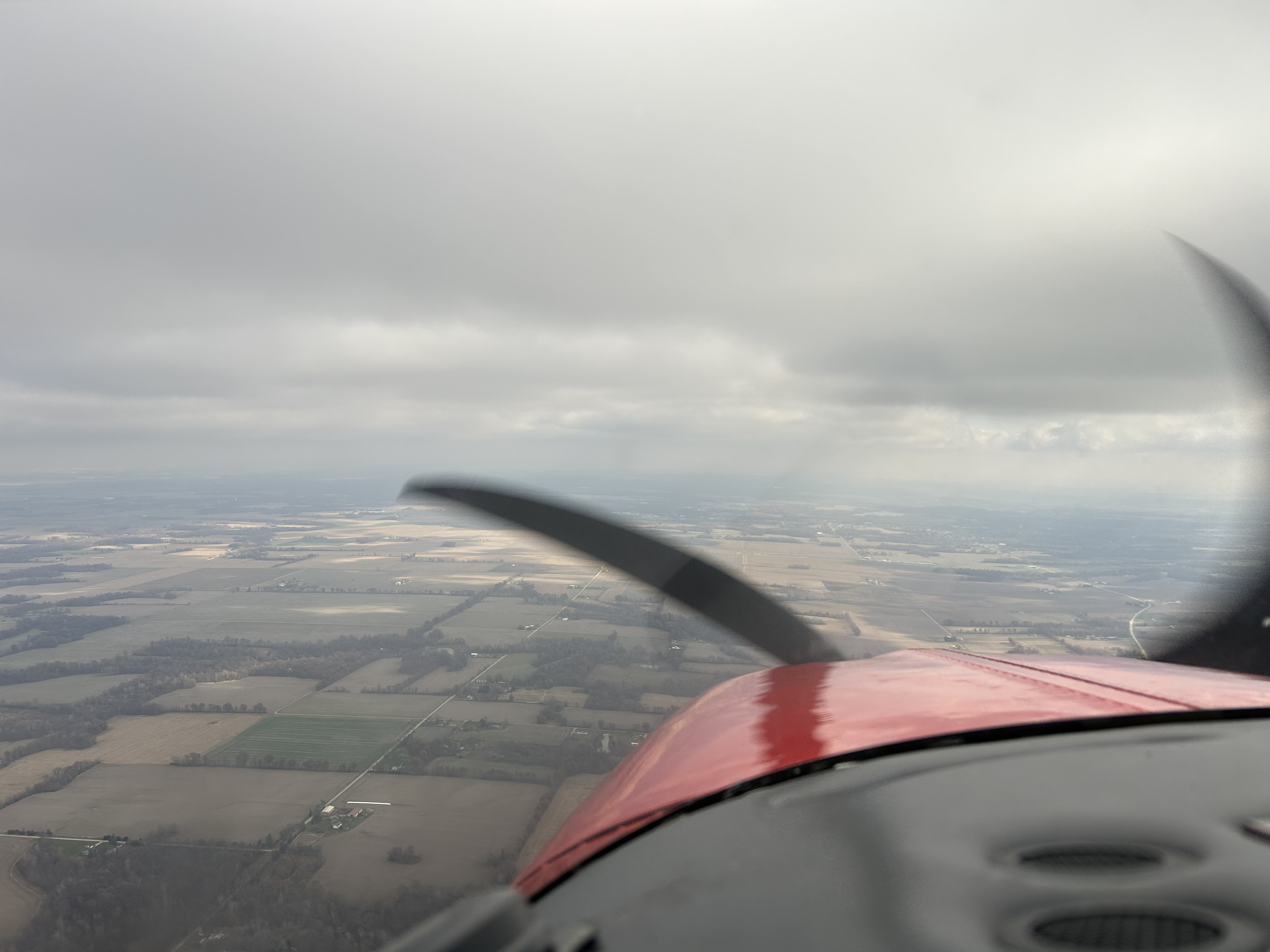
Beneath the clouds and ice.
As I flew east the sky to my left grew darker and I could see several areas of isolated snow showers. The Outside Air Temperature (OAT) at 3000 feet was -10°C so any encounter with the flurries should be ice-free, the completely frozen flakes simply bouncing off the airframe. Up in the thicker clouds would be a different story, as new icing PIREPs on my 796 confirmed.
Making the turn northeast at YUPUR I flew through a couple small bands of flurries that limited visibility to instrument levels, slipping through them aerodynamically unaltered as expected. About three miles from the airport ATC gave me a vector for a downwind behind one of the larger Cessna Citation jets on a three-mile visual final. I popped out of the snow abeam the airport and saw the jet touching down, reported the airport in sight and was cleared for the visual approach. Turning base, I canceled my IFR clearances and completed my trip.

Plan the flight and fly the plan…but be flexible, too
As it turns out the way I flew was probably the only way I could have made It safely all the way in the airplane. If I had cancelled IFR over eastern Illinois I would have had to divert because of the snow showers. In or above the icy clouds would likely have been disastrous.
I was ready for any combination of planes, trains and automobiles to get to my family Thanksgiving celebration. My experience and train[ing] on aviation weather and risk management allowed me to create a plan to avoid the hazards, including options for changing plans at any point from before takeoff to landing, and then fly that plan.
My flight home was something of a mirror image, at 4000 MSL into the wind under a cold overcast for 2.5 hours to a fuel stop, then climbing above a broken layer for the leg home, then clouds rapidly fading away in warmer air for another two hours until I was home.
Thanks for flying with me on another Thanksgiving trip drawing LESSONS from this year’s decision-making practice, experience and reinforcement.
Questions? Comments? Supportable opinions? Let us know at [email protected].

Debrief
Readers write about recent FLYING LESSONS
In the November 21 LESSONS I related some of what I learned at the 2024 Bombardier Safety Standdown, particularly several quotes from corporate aviation guru Dr. Tony Kern. I invited my readers to expound on the Kern-als of knowledge I related in that report and a few of youmdid ust that. Reader Karl Kleiderer writes:
An example of the following Kern-al:
“Even if you are experienced, safe and compliant, the rest of the world is not.”
This happened just a few weeks ago coming into my home airport under the local Class Bravo [airspace]. I was on an IFR flight plan under control of Approach. The entire area was covered in low overcast with between 500 feet and 700 feet overcast ceilings. I had received a descent from 7000 to 5000 and had started a 500 fpm descent when I saw on two devices an ADS-B target at my altitude, also descending, and on what we in the military would call a “merge plot.”
I incorrectly assumed (as it turned out) that we would both be talking to ATC given the weather. I waited an uncomfortable amount of time for one of us to get a “stop your descent and maintain 6000” [call] that never came. I queried ATC, “what are we doing with the traffic at my 2 o’clock?” to which there was a significant pause and then a command that there’s a VFR target 200 feet above me and to descend immediately. I was already in a 45-degree AOB [angle of bank] turn and evading the traffic I could now see very close out the right window. As my debrief with the ATC Executive Officer would later reveal, we came within 0.75nm and co-altitude, with ATC collision alarms going off for a full 20 seconds in the TRACON…and that was after both of us turned to avoid each other.
Very vigilant. I’ve also seen ADS-B targets and have even been given “altitude not verified” traffic callouts from controllers about VFR airplanes when looking out the window it was obvious the other aircraft was in instrument meteorological conditions (IMC) or at least in a position where it was almost certain the pilot was not maintaining at least visual flight rules (VFR) cloud clearance requirements. It’s always vital to use all available resources for traffic avoidance, and to anticipate pilots may be noncompliant with VFR minimum cloud clearance and visibility requirements in marginal or instrument conditions. Asking a controller to verify what you are seeing on your onboard traffic is a good survival tactic, one made necessary knowing other pilots may not be as compliant as you. Thanks, Karl.
Reader Anita Kazarian adds:
[Tony Kern wrote:] “The things we need to be ready for are in addition to the things we regularly train for.”
[This] reminds me of the Black Swan Event*. Even being hypervigilant we cannot anticipate Black Swan events. However, if we understand Black Swan events happen in GA [general aviation], our philosophy of safety and being hypervigilant will at least reduce the startle time allowing us a greater probability of exiting the event safely.
*A black swan is an unpredictable event that is beyond what is normally expected from a situation and that has potentially severe consequences. Black swan events are characterized by their extreme rarity, severe impact, and the widespread insistence they were obvious in hindsight.
You write in the language of the Safety Standdown, Anita. I heard the term Black Swan Event from at least one speaker at the event. Were you there? Thank you.
I’ll include more reader Debrief items from the immediate past issue next week. Thank you.
More to say? Let us learn from you, at [email protected]

Share safer skies. Forward FLYING LESSONS to a friend.
Please help cover the ongoing costs of providing FLYING LESSONS through this secure PayPal donations link. Or send a check made out to Mastery Flight Training, Inc. at 247 Tiffany Street, Rose Hill, Kansas USA 67133. Thank you, generous supporters.
Thank you to our regular monthly financial contributors:
Steven Bernstein, Montclair, NJ. Robert Carhart, Jr., Odentown, MD. Randy Carmichael, Kissimmee, FL. Greg Cohen, Gaithersburg, MD. John Collins, Martinsburg, WV. Dan Drew. Rob Finfrock, Rio Rancho, NM. Norman Gallagher. Bill Griffith, Indianapolis, IN. Steven Hefner, Corinth, MS; Ellen Herr, Ft Myers, FL. Erik Hoel, Redlands, CA. Ron Horton. David Karalunas, Anchorage, AK. Steve Kelly, Appleton, WI. Karl Kleiderer. Greg Long, Johnston, IA. Rick Lugash, Los Angeles, CA. Richard McCraw, Hinesburg, VT. David Ovad, Resiertown, MD. Steven Oxholm, Portsmouth, NH. Brian Schiff, Keller, TX. Paul Sergeant, Allen, TX. Paul Uhlig, Wichita, KS. Richard Whitney, Warrenton, VA. Jim Preston, Alexandria, VA. Johannes Ascherl, Munich, Germany. Bruce Dickerson, Asheville, NC. Edmund Braly, Norman, OK. Steven Hefner. Lorne Sheren, New Vernon, NJ. “The Proficient Pilot,” Keller, TX. Ed Stack, Prospect Heights, IL. Kynan Sturgiss, Hereford, TX
And thanks to these donors in 2024:
Jim Lara, Joseph Stadelmann, Dixon Smith, Barry Warner, Wayne Mudge, Joseph Vandenbosch, Ian Campbell, Jay Apt, John Kimmons, Derek Rowan, Michael Maya Charles, Ron Horton, Lauren McGavran, Gerald Magnoni, Amy Haig, Rod Partlo, Brent Chidsey, Mard Sasaki-Scanlon, SABRIS Aviation (Dave Dewhirst), Edmund Braly, Joseph Orlando, Charles Lloyd, Michael Morrow, Abigail Dang, Thomas Jaszewski Danny Kao, Gary Garavaglia, Brian Larky, Glenn Yeldezian, David Yost, Charles Waldrop, Robert Lough. Gilbert Buettner. Panatech (Henry Fiorientini). Dale Bleakney. Mark Kolesar. John Winter. Donald Bowles. David Peterson. Bill Abbatt. Bruce Jacobsen. Denny Southard, Wayne Cloburn, Ross Ditlove. “Bonanza User,” Tad Santino, Steven Scharff, Kim Caldwell, Tom Carr, Michael Smith.
NEW THIS WEEK: David Kenny, Lorne Sheren, Stu Spindel, Martin Sacks
Pursue Mastery of Flight(TM)
Thomas P. Turner, M.S. Aviation Safety
Flight Instructor Hall of Fame Inductee
2021 Jack Eggspuehler Service Award winner
2010 National FAA Safety Team Representative of the Year
2008 FAA Central Region CFI of the Year
FLYING LESSONS is ©2024 Mastery Flight Training, Inc. For more information see www.thomaspturner.com. For reprint permission or other questions contact [email protected].
